Gunpowder Falls

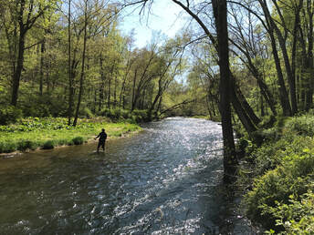
From its origins as a spring creek in south central Pennsylvania, Big Gunpowder Falls flows nearly 60 miles to the Chesapeake Bay. Locally the river is usually referred to just as the Gunpowder. The main fishing area runs from below Prettyboy Reservoir, near Hereford, Maryland, to Phoenix Road near Hunt Valley, Maryland. The Gunpowder is considered one of Maryland’s premier wild trout streams and is listed in Trout Unlimited’s Top 100 trout steams in America.
Presently, 7.2 miles of the Gunpowder Falls between Prettyboy dam and Blue Mount Road are managed for wild trout under catch-and-return, flies and artificial lures only regulations. Statewide wild trout regulations (2 trout/day, no size or bait restrictions) apply from Blue Mount Road downstream 4.2 miles to Corbett Road. The remaining 6.1 miles from Corbett Road downstream to a hiker/biker trail approximately one mile below Phoenix Road are stocked with hatchery rainbow trout. This stream section is stocked in the spring and fall and provides a popular put-and-take fishery with a five trout/day limit and no bait restrictions. There are closed periods during the spring to allow for stocking. Check with DNR for closures.
In the park area stream access is excellent with parking at Falls Road, Masemore Road, Bunker Hill Road, York Road and Blue Mount Road. A well maintained network of hiker trails parallels the river through most its length. Below Blue Mount Road the river is bordered by private land and there are fewer points of access.
Maryland Trout Unlimited was instrumental in establishing the constant flow, cold water release from Prettyboy that supported the evolution a wild trout stream. Maryland Trout Unlimited’s efforts have also been directed at Little Falls and Jones Falls streams.
Morgan Run

Morgan Run is a comfortable and pleasing place to fish within 45 minutes of Baltimore and about an hour outside of Washington, D.C. The stream typically has a high density of trout, is stocked by DNR, and offers some of the best fishing in the area.
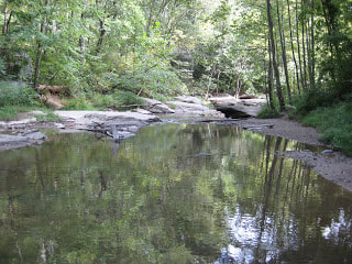
Located in Carroll County, the catch-and-release section begins where Route 97 crosses the stream and winds through wooded hills and plains for a few miles until it reaches London Bridges Road. The stream has two alternating personalities, changing between a low gradient stream with log jams, undercut banks, and gravel bottom to a faster moving rocky bottom stream with plenty of chutes, riffles, and the occasional boulder strewn in for fun. Morgan run is a pretty stream canopied by trees, flora, and plenty of wildlife to complete the picture.
There are three access points with parking lots: Jim Bowers Road for the upper section, Klees Mill Road for the middle section, and London Bridges Road for the lower section. To get to Jim Bowers Road, take Route 97 to Nicodemus Rd., go East on Nicodemus Road and after about a mile, make a sharp right onto Jim Bowers Road. The dirt road at the end of Jim Bowers Road will take you to the stream. Park in the parking lot and take the obvious paths to the stream. The other access points can be located on a map included in the book Guide to Maryland Trout Fishing, the Catch-and-Release Streams.
Patapsco River
Daniels Dam Area

The Patapsco River flows for many miles before emptying into the Chesapeake Bay. The Daniels area, bordering Howard and Baltimore Counties, is located in Patapsco Valley State Park. It is a favorite among local fly fishers and offers about two miles of trout water.
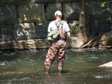
The Daniels area is located in a scenic setting. The upper reaches include the Daniels Dam, over which water plunges into a section of the stream that simply looks “fishy”. The river is well stocked with rainbows and browns in the spring and fall. In the warm summer months when the water is low this is good smallmouth water. The river bottom is filled with rocks and pebbles and at times can be difficult to wade. A wading staff is good idea. The river is quite open which makes casting a pleasure.
Stream access is relatively easy. Just North of Rt 29, you can find your way to the Daniels Dam area by taking Old Frederick Road and then turning left onto Daniels Road which takes into a parking lot below the dam. There are plenty of access paths to follow down to the river. There is also an open path located on the far side of the river that gives you easy access to the downstream section. A second main access point is located by staying on Old Frederick until you come to a bridge. Before crossing, you can park in a small lot to the right of the bridge. From here you can fish upstream or downstream.
The Patapsco is an excellent alternative to the traditional catch-and-release streams in the area.
Patuxent River

The catch-and-release section of the Patuxent River is about a 12 mile stretch of water within an hour’s drive
of both Baltimore and Washington, D.C. The stream is located within the Patuxent River State Park and is the dividing line between Howard and Montgomery counties.
The Patuxent is a low gradient stream that winds slowly though wooded areas and a few meadows. The river ranges from about 15 to 40 feet wide and mostly has a gravel bottom. The angler will find some riffles, runs, and chutes with the occasional deep hole. There is a fine canopy of trees that help keep the river relatively cool even in the midst of summer. The river is stocked with both browns and rainbows and many fish remain holdovers with some natural reproduction occurring, mostly with brown trout. One exciting feature of the river is the chance to catch a large brown. Each year there are reports of fish over 20” being taken and released back to the water.
The Patuxent River Special Area borders Howard and Montgomery County and runs parallel to Route 650, Old Damascus Road. The best fishing is from Route 97 upstream to where Long Corner Road crosses the river. A detailed map can be found in Guide to Maryland Trout Fishing, the Catch-and-Release Streams.
Western Maryland
WV/VA/PA & beyond
MDTU members live within a short drive of many amazing trout fisheries for weekend and day trip adventures.